


Fairview Precinct, Sarpy County, Nebraska
About
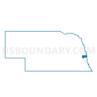
Outline

Summary
| Unique Area Identifier | 613794 |
| Name | Fairview Precinct |
| County | Sarpy County |
| State | Nebraska |
| Area (square miles) | 13.31 |
| Land Area (square miles) | 13.30 |
| Water Area (square miles) | 0.01 |
| % of Land Area | 99.96 |
| % of Water Area | 0.04 |
| Latitude of the Internal Point | 41.11336640 |
| Longtitude of the Internal Point | -96.05815240 |
Maps


Graphs
Select a template below for downloading or customizing gragh for Fairview Precinct, Sarpy County, Nebraska


Neighbors
Neighoring Voting District (by Name) Neighboring Voting District on the Map
- Bellevue Second 1 Precinct, Sarpy County, NE
- La Platte 1 Precinct, Sarpy County, NE
- La Platte 4 Precinct, Sarpy County, NE
- Papillion 3-3 Precinct, Sarpy County, NE
- Platford Springfield 2 Precinct, Sarpy County, NE
- Platford Springfield 3 Precinct, Sarpy County, NE
- Richland 1 Precinct, Sarpy County, NE
- Richland 3 Precinct, Sarpy County, NE
Top 10 Neighboring County Subdivision (by Population) Neighboring County Subdivision on the Map
- Papillion precinct, Sarpy County, NE (18,894)
- Papillion Second I precinct, Sarpy County, NE (7,222)
- Bellevue Second II precinct, Sarpy County, NE (4,480)
- Bellevue Second III precinct, Sarpy County, NE (4,222)
- Papillion Second II precinct, Sarpy County, NE (3,361)
- LaPlatte I precinct, Sarpy County, NE (2,896)
- Fairview precinct, Sarpy County, NE (1,896)
- LaPlatte II precinct, Sarpy County, NE (1,256)
- Platford-Springfield I precinct, Sarpy County, NE (933)
Top 10 Neighboring Place (by Population) Neighboring Place on the Map
Top 10 Neighboring Unified School District (by Population) Neighboring Unified School District on the Map
Top 10 Neighboring State Legislative District Upper Chamber (by Population) Neighboring State Legislative District Upper Chamber on the Map
Top 10 Neighboring 111th Congressional District (by Population) Neighboring 111th Congressional District on the Map
Top 10 Neighboring Census Tract (by Population) Neighboring Census Tract on the Map
- Census Tract 102.05, Sarpy County, NE (5,436)
- Census Tract 106.24, Sarpy County, NE (5,248)
- Census Tract 102.03, Sarpy County, NE (4,768)
- Census Tract 107.02, Sarpy County, NE (3,603)
- Census Tract 106.20, Sarpy County, NE (3,185)
- Census Tract 102.08, Sarpy County, NE (2,921)
- Census Tract 106.29, Sarpy County, NE (1,803)